FLYING ABOVE THE CLOUDS
Full length video
Please read Understanding catalogue records for help interpreting this information and Using footage for more information about accessing this film.
Title: FLYING ABOVE THE CLOUDS
Reference number: 1272
Date: 1941*
Sponsor: GB Instructional Ltd.
Production company: Junior Activity Films
Sound: silent
Original format: 16mm
Colour: col
Fiction: non-fiction
Running time: 10.40 mins
Description: Two boys are taken on a flight from Renfrew airport. They are shown how the flight instruments work. The trip takes them over the Clyde estuary.
Credits: p. John C. Elder
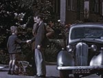
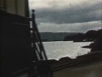
Shotlist: Credits (.27); General shots at Renfrew Airport with shots of a Vickers "Viking" landing and close-up of a Dragon "Rapide" passenger bi-plane. (.53); Archie and I went for a flight with a friend who is an airway pilot. The two boys meet the pilot and then board the plane, registration G-AGUB (1.13); We were shown the instruments in the cockpit. Close-up of instruments (1.23); The dials show the inclination of the plane, the altitude or height, and the speed through the air. Close-ups of the instruments (1.35); The rudder bar worked by the pilot's feet. Close-up of same (1.44); Moves the tail fin. Shot of tail fin moving (1.49); The joy stick operates the elevators. Shots of same (1.59); And the aelirons on the wings. Shot of same (2.11); When the ground control gave the OK, we took off. Close-ups of ground control officer operating a hand-held spot lamp and shot of the plane taking off (2.30); Houses and towns began to look like toys. Aerial shots of town and countryside (3.21); We climbed up through the clouds into clear sunshine. Shots from plane of clouds (3.56); Coming back down through the clouds to about 500 ft., we crossed the coastline. Aerial shots of the coastline, possibly Ayrshire (4.20); Approaching an island we climbed and watched it become smaller and smaller as we gained altitude. Shot of same of 2,000 ft., 4,000 ft., 6,000 ft., and 7.500 ft. (5.02); At about this height the island looked like a map. Shots of a map (5.21); We swooped down towards the lighthouse. Shots of same (6.13); Circling the island we swept past the lighthouse at about 2000 ft. Shots of same (6.23); Returning to the mainland, we followed the coast passing several holiday resorts. Aerial shots of coastal town - possibly Largs - and shots of the coastline (7.14); At the mouth of the estuary, we turned up river. Aerial shots of coastline including Cloch lighthouse, an unidentified paddle steamer, Gourock, Greenock, clouds and Dumbarton Rock (8.24); We had to climb for the cross country flight back to the aerodrome. Aerial shots of countryside and shots of plane landing at Renfrew airport (9.10). Little Cumbrae is the island.