FORTH - POWERHOUSE FOR INDUSTRY
Full length video


Please read Understanding catalogue records for help interpreting this information and Using footage for more information about accessing this film.
Title: FORTH - POWERHOUSE FOR INDUSTRY
Reference number: 1820
Date: 1968
Director: d. Henry Cooper
Sponsor: Educational Films of Scotland
Production company: Campbell Harper Films Ltd.
Sound: sound
Original format: 16mm
Colour: bwcol
Fiction: non-fiction
Running time: 20.36 mins
Description:
A look at the development of sources of power, the industries, and new towns along the borders of the River Forth.
Working title FORTH ESTUARY.
File containing correspondence, scripts etc.
Credits:
p. Alan Harper
sc. and comm. w. Dr. J. B. Barclay
nar. Bryden Murdoch
ph. Mark Littlewood
sd. rec. Brian Henniker.
The producers wish to acknowledge the assistance given by the National Coal Board, Scottish Division; The South of Scotland Electricity Board, Leith Dock Commission; British Transport Docks, Grangemouth; H. M. Dockyard, Rosyth; British Hydrocarbon Chemicals.
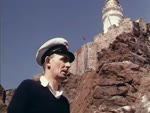
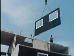
Shotlist: title and credits (0.10); shots of the River Forth and some historic monuments beside it eg Linlithgow Palace (0.41); long shot of large electricity station - possibly Longannet (0.50); panning shots of the Forth Road Bridge and Rail Bridge (1.09); shots of the Bass Rock (?) (1.13); long shot of Isle of May (1.20); shots of combine harvester at work in field (1.33); shots of fishing village on East Neuk of Fife, probably Crail (?) (1.40); shot of map showing coal areas (1.59); shots of pitheads and the more modern enclosed shafts (2.10); shots of power station (2.40); [BW] underground shots of miners at work, joining up Kinneil Colliery on South Shore to Valleyfield on North Shore via tunnel under the Forth (3.19); [COL] long shots and panning shots of an open cast quarry and lorries carrying varying loads, Westfield (4.27); shots of a gas factory, Lurgie Gasification Plant (4.49); more shots of quarry, strata clearly visible (5.01); shots of fields being worked, spreading topsoil and returning to agricultural use (5.30); shots of map showing electricity stations - Methil, Longannet, Kincardine, Cockenzie (5.35); panning shots of Cockenzie power station, coal being supplied from Monktonhall Colliery to fuel the station (7.00); brief interior shots of power station, control room (7.07); shots of electricity pylons and shots of power station from all angles, including cables going over the Forth. gvs Longannet Power Station under construction. gvs Methil power station where slurry is processed. exts Kincardine Power Station and shot of bridge. brief shot Grangemouth (9.07); map showing industrial areas - Grangemouth, Leith, Bathgate (9.17); shots of different factories - Shell, cars, lorries, Uniroyal etc. Petroleum products are delivered to Grangemouth. exts office blocks and staff boarding bus at Grangemouth. gvs Bathgate with trucks and vehicles lined up in yard. exts Cameron Iron Works in Livingstone. exts Newbridge tyre factory. gvs derelict land being reclaimed (12.02); shots of Royal Highland Show and Highland Games at Ingliston (12.55); map showing docks of the Forth - Grangemouth and Leith (13.01); shots of docks with 'Sea Land' lorries being loaded on board a cargo ship and shots of foreign ships loading and unloading cargo and freight (15.15); shots of cranes and Joseph Rank Ltd Caledonia Flour Mill. gvs Leith Docks and general constuction works with extension of the dock area underway (15.29); shots of shoreside dumping grounds and dockland. gvs Rosyth shipyard (16.57); shots of tenements and high-rise flats, Leith. Tall flats at Kirkcaldy (17.24); map showing new towns at Glenrothes, Livingston (17.31); panning shots of new towns areas of Glenrothes and Livingston - shops, school, houses, flats. Shows the pedestrian nature of these new towns (18.57); shots of railway line panning to Forth Bridges (19.27); map showing Coal, Electricity, Industry, Docks, New Towns, and general summing up of the topics covered in the film (19.51); ecs (20.36)