FUKUSHIMA: Radiation Map and Evacuation
Full length video

Please read Understanding catalogue records for help interpreting this information and Using footage for more information about accessing this film.
Title: FUKUSHIMA: Radiation Map and Evacuation
Reference number: 13710
Date: 2020
Director: d. Yushin Toda
Production company: Japan Desk Scotland
Sound: sound
Original format: unknown
Colour: col
Fiction: non-fiction
Running time: 65.12 mins
Description: Japan Desk Scotland’s eighth documentary about the Fukushima nuclear accident in 2011, looking back at the work to create a radiation map of the surrounding area and the establishment of the Institute of Environmental Radioactivity in 2013.
Credits:
p. Fumi Nakabachi and Yushin Toda, Japan Desk Scotland
comm. w. Yushin Toda
ph. Fumi Nakabachi
ed. Yushin Toda
m. Oli Jan
Shotlist:
Filmmaker's synopsis:
This is Japan Desk Scotland’s eighth Fukushima documentary, based on the interviews carried out in December 2012 and in July 2019.
When a nuclear accident occurred in Fukushima, following the earthquake and the tsunami on 11 March 2011, Fukushima University had neither a research group on nuclear issues nor facilities, but a group of Fukushima University scientists voluntarily measured air dose rates and made the radiation map of Fukushima, the first of its kind based on actually measured dose rates. The map revealed that air dose rates were high outside the evacuation zone, and the map is said to have played a role in changing the government’s evacuation plan. To record their activities and thoughts, interviews were carried out with Kenji Nanba and Kencho Kawatsu, two of the voluntary team, in December 2012, which formed the core of JDS’s first Fukushima documentary. Since then Fukushima was visited annually until 2019 to record what was happening in Fukushima, primarily following these two people.
In July 2019, an interview was carried out with Takayuki Takahashi, another member of the voluntary team and then Vice President (Research). Combining his interview with the previous two interviews, this is a more comprehensive account of how and why the radiation map was made than the previous one. For example, Takahashi states that the university’s senior management was divided at the time of the accident: to deal with the accident or to run away from it. He also states how the voluntary team created momentum in the university, leading to the establishment of the Institute of Environmental Radioactivity in 2013.
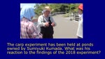
IER has several observation sites in Fukushima, one of which is owned by Mr and Mrs Sanpei, Tsushima area of Namie Town. They talk about how they evacuated from their home immediately after the nuclear accident. Tsushima area is inside the ‘Difficult-to-Return’ zone still under the evacuation order. When they allowed IER to use their forest as its observation site, he asked Vasyl Yoschenko, a specialist on forest radio-ecology from Ukraine, “Is your research necessary?” He needs to answer this question by showing his research outcome. He is supported by IER’s two coordinators, Kenji Watanabe and Hiroko Nagata.
Interviewees (in order of their first appearances):
Takayuki Takahashi, Kenji Nanba, Kenji Watanabe, Kencho Kawatsu, Senjiro Sanpei, Vasyl Yoschenko, Hiroko Nagata, and Noriko Sanpei